Deliverables & Specs
Enterprise-Grade Hardware. Engineering-Grade Deliverables.Enterprise-Grade Hardware Engineering-Grade Deliverables
Every flight is captured with the Autel EVO Max 4T's radiometric thermal sensor, 10x optical zoom, and millimeter-wave radar obstacle avoidance, then delivered as GeoTIFF orthomosaics, vector-traced DXF/DWG CAD overlays, a rotatable 3D model, a geo-tagged PDF asset register, and a priority-ranked PDF defect matrix.
Fleet & Hardware Authority
Enterprise-Grade Equipment. Never a Hobby Drone.
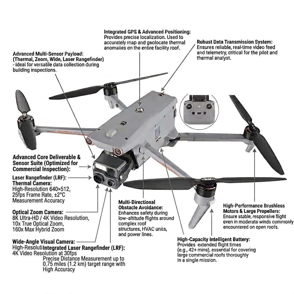
Autel EVO Max 4T
640×512 Radiometric Thermal Sensor
Full-frame radiometric capture — every pixel is a temperature reading, not a color approximation.
8K / 10x Optical, 160x Hybrid Zoom
Inspect high-voltage RTUs and rooftop electrical gear from a 100 ft safety buffer, no lift required.
720° Omnidirectional Obstacle Avoidance
Binocular vision plus millimeter-wave radar cover every direction, day or night, for zero-risk flights around parapets, HVAC clusters, and active loading-dock yards.
Built-In Laser Rangefinder
Ranges up to 0.75 mi with sub-meter accuracy for precise roof pitch, drain slope, and parapet height data.
42-Minute Flight Time, Hot-Swappable Battery
More roof covered per battery, and field-swappable packs mean no downtime between sections of a large facility.
12.4-Mile SkyLink Transmission Range
Rock-solid live video and telemetry across sprawling industrial parks, warehouse campuses, and rooftop clusters.
What This Means for YouEvery pixel is an exact temperature reading, so trapped moisture and electrical hot spots show up precisely instead of a rough color guess.
What This Means for YouRead serial numbers, cracks, and corrosion up close from a safe hover — no ladders, lifts, or foot traffic on your roof.
What This Means for YouDual vision + radar sensing in every direction, day or night, for safer, faster flights around tight rooftop equipment and parapets.
What This Means for YouMore of your facility gets covered per battery, meaning less waiting around for swaps during a site visit.
What This Means for YouGeo-referenced CAD overlays so measurements and layouts stay proportionally accurate for bids and planning.
Fleet Expansion — Coming Soon
Adding the Skydio X10 to the Fleet
A second, NDAA-compliant airframe alongside our Autel EVO Max 4T — built for autonomous obstacle avoidance in tighter, more complex environments and for sites where compliance requirements rule out foreign-made hardware.
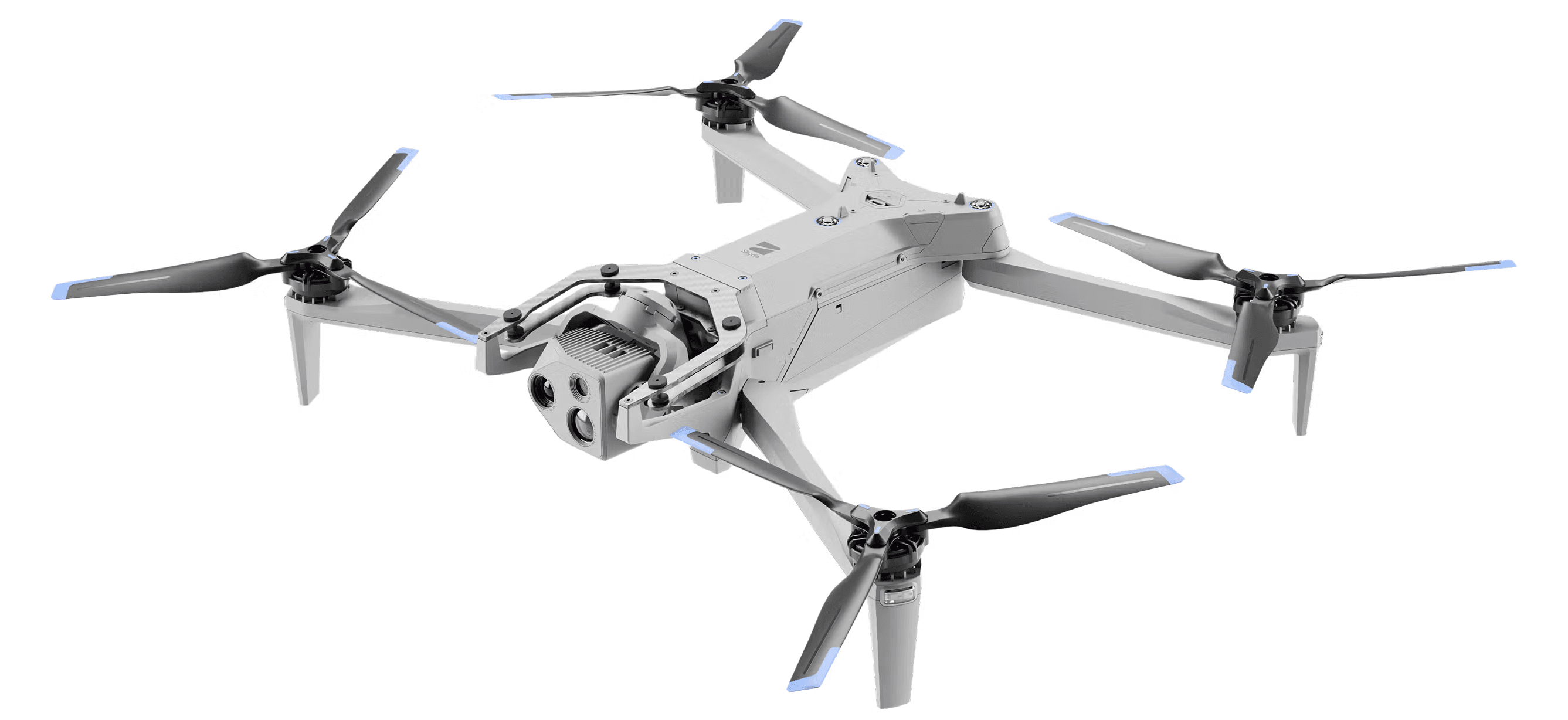
Skydio X10
64MP Narrow + 48MP Telephoto (190mm) Modular Payload
Swappable sensor packages built for close-in detail work on facades, structural members, and rooftop equipment from a safe standoff distance.
640×512 Radiometric Thermal (VT300 Payloads)
Same full-frame temperature-per-pixel capture as our current fleet, on a second airframe for redundancy and parallel tasking on larger sites.
360° Autonomous Obstacle Avoidance
Six navigation cameras and an onboard NVIDIA Jetson Orin GPU give full-surround awareness in tight, GPS-denied, or visually complex environments.
40-Minute Flight Time, 45 MPH
Longer coverage per battery and enough speed to move quickly between buildings on multi-structure commercial and industrial sites.
Up to 7.5-Mile Transmission Range
Skydio Connect SL keeps live video and telemetry solid across large industrial parks and campuses; cellular-linked range for sites that need it.
NDAA-Compliant Airframe
Built to a different compliance standard than our current fleet, opening the door to sites with federal, utility, or restricted-airspace requirements.
Same platform, local track record: the Skydio X10 is the drone the Harford County Sheriff's Office operates for its Drone as First Responder program — watch Skydio's case study
The X10 is being onboarded now — pilot training, insurance, and payload configuration are in progress ahead of its first client engagements. Ask about availability when you request a bid.
Deliverable File Formats
GeoTIFF
Georeferenced nadir orthomosaic at sub-centimeter-per-pixel resolution, ready for GIS platforms.
What this means for you: Think of it as an ultra-zoomed-in map of just your property — so precise you can click anywhere on-screen and measure exact distances or square footage yourself, right on the image.
DXF / DWG
Millimeter-accurate, layer-separated CAD overlays built for commercial roofers and general contractors.
What this means for you: A ready-to-use digital blueprint of your building. Your contractor or architect opens it directly in their design software and starts marking up repairs immediately — no manual re-measuring or redrawing required.
PDF Asset Register
Geo-tagged inventory of every RTU, drain, and rooftop asset, condition-logged and pinned to the property map.
What this means for you: A GPS-mapped inventory of every HVAC unit, fan, and piece of equipment on your roof, with condition notes and ID tags, so your maintenance team always knows exactly what's up there.
3D Model (OBJ / GLB)
Multi-angle aerial capture reconstructed into a rotatable 3D model, built for construction coordination and complex roof geometry.
What this means for you: A model you can rotate and view from any angle, not just from above — so a multi-pitch roof, an addition, or a cluttered mechanical yard is actually easy to plan around, instead of guessing from a flat photo.
PDF Defect Matrix
Priority-ranked (Critical / Maintenance Required / Monitored) report formatted for insurance claims and reserve studies.
What this means for you: A simple, easy-to-read report ranking every issue we found by urgency, so you know what needs fixing now versus what can wait — ready to hand straight to your insurance adjuster or contractor.
See a Real Example
Every format above, as an actual file — request a free sample deliverable set and we'll send you real examples directly.
What this means for you: No need to take our word for it — see the actual GeoTIFF, CAD overlay, 3D model, or report format before you commit to a paid flight.